By the time the sun rose over the Bay of Bengal on October 27, 2025, the sky had already begun to whisper warnings — not in clouds, but in data. India Meteorological Department had issued its most urgent bulletin yet: Cyclone Montha was no longer a distant disturbance. It was a monster gathering strength, 600 kilometers offshore, moving northwest at 16 km/h, and set to slam into the Andhra Pradesh coast between Machilipatnam and Kalingapatnam that very night. Wind speeds? 90–100 km/h, gusting to 110. Rainfall? Extreme. Lives? At risk.
Why This Cyclone Is Different
Most cyclones fade quietly. Not this one. Cyclone Montha is being tracked with unusual precision — and urgency — by the Indian National Centre for Ocean Information Services (INCOIS) in Hyderabad. Since detecting its formation as a depression on October 25 at 2:00 p.m. IST, INCOIS has issued six hourly updates. That’s rare. It means meteorologists aren’t just watching — they’re preparing for the worst-case scenario. The name itself tells a story. Cyclone Montha was contributed by Thailand, part of an eight-nation rotating list that includes India, Bangladesh, Sri Lanka, and others. Each name is chosen to be culturally neutral, easy to pronounce, and memorable. Montha — meaning "rose" in Thai — is now a symbol of destruction. Irony, perhaps, but it’s the system’s way of humanizing the storm.On the Ground: Schools Closed, Beaches Shut, Rescue Teams Deployed
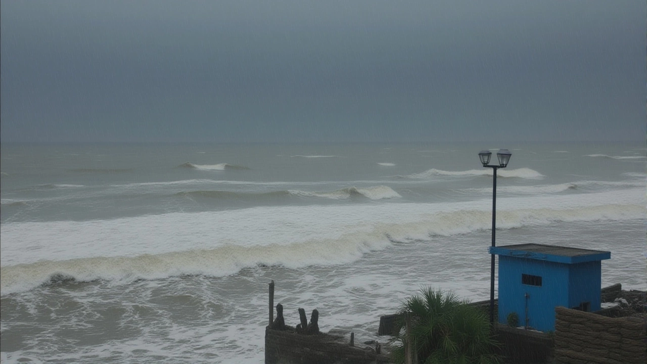
In Visakhapatnam, children didn’t go to school on October 27. Not because of a holiday, but because the Andhra Pradesh Education Department ordered a two-day closure in districts expected to bear the brunt: Visakhapatnam, Anakapalle, and West Godavari. Parents were told to keep kids indoors. Schools became temporary shelters. Meanwhile, the Andhra Pradesh State Disaster Response Force rolled out 12 specialized teams — 144 personnel, 24 inflatable boats, 12 high-capacity water pumps. Their mission: reach every low-lying village before the tide turns. "We’re not waiting for calls," said Director General E. Usha Rani in her 4:00 p.m. briefing on October 26. "We’re going to them." Beaches from Puri to Kakinada are now off-limits. The Andhra Pradesh Tourism Department shut down all coastal access points effective 6:00 a.m. on October 27. Lifeguards in Odisha stood shoulder-to-shoulder on Puri Beach, waving off tourists who still dared to wade into the surf. "The sea isn’t just rough," said one guard. "It’s angry. And it doesn’t care if you’re just taking a selfie."Prime Minister’s Emergency Call and the National Response
At 7:30 p.m. on October 26, Narendra Modi convened a high-level meeting at 7 Lok Kalyan Marg in New Delhi. By 8:00 p.m., the National Emergency Response Centre was fully activated under Director General Atul Karwal. Within hours, Modi had personally spoken with YS Jagan Mohan Reddy, the Chief Minister of Andhra Pradesh. The conversation wasn’t about politics. It was about tarpaulins. Sandbags. Emergency rations. Over 50,000 of each have been pre-positioned in vulnerable districts. "We’re not just protecting homes," Reddy told reporters. "We’re protecting livelihoods. Rice paddies, fish ponds, coconut groves — they’re not replaceable in a week." The National Disaster Management Authority — chaired by Modi — has mobilized its entire network. Helicopters are on standby. Food packets are being airlifted. The Indian Navy’s Eastern Command has issued a marine alert: sea conditions will remain "rough to very rough" until October 29.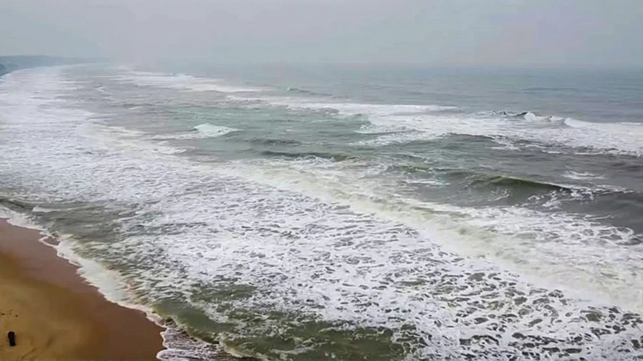
Rain, Wind, and the Hidden Threat
The wind is terrifying. But the real killer? The rain. The India Meteorological Department forecasts "isolated extremely heavy rainfall" across four zones:- Coastal Andhra Pradesh: October 27–29
- Odisha: October 28–29
- Chhattisgarh: October 28
- Saurashtra & Kutch: October 27
What Comes After the Storm
The immediate threat ends when the eye passes. But the aftermath? That’s where the real battle begins. Power lines will snap. Roads will vanish under water. Crops — especially paddy fields in Krishna and Guntur districts — could be wiped out. Farmers who planted just weeks ago now face ruin. The government has promised compensation, but the delay in claims often stretches months. And then there’s the mental toll. People who lost homes in Cyclone Fani in 2019 are already talking. "We thought we were ready," said a shopkeeper from Kakinada. "But when the wind screams like that? You forget how to breathe." The National Disaster Response Force has pre-deployed medical teams. Mental health counselors are being flown in. This isn’t just about rebuilding houses. It’s about rebuilding trust.
What’s Next?
The next 12 hours are critical. Will Cyclone Montha maintain its strength? Or will friction with land weaken it before impact? The IMD’s 6 a.m. update on October 28 will be decisive. Meanwhile, the public is being urged to:- Stay indoors — no exceptions
- Charge phones and keep emergency numbers handy
- Store drinking water and non-perishable food
- Listen to local radio — not just WhatsApp forwards
Frequently Asked Questions
How dangerous are the wind speeds predicted for Cyclone Montha?
With sustained winds of 90–100 km/h and gusts up to 110 km/h, Cyclone Montha qualifies as a "severe cyclonic storm" — strong enough to uproot trees, collapse weak structures, and damage power infrastructure. For context, this is comparable to Cyclone Amphan in 2020, which caused over $13 billion in damage. Homes without reinforced roofs are at high risk.
Why are schools closed in Visakhapatnam, Anakapalle, and West Godavari?
These three districts lie directly in the projected path of landfall. The Andhra Pradesh Education Department declared a two-day holiday to ensure children and staff are not caught in evacuation chaos or flooding. Schools are being converted into emergency shelters, with food, water, and medical supplies pre-stocked. Over 300 schools are now designated relief centers.
What’s the role of INCOIS in tracking Cyclone Montha?
The Indian National Centre for Ocean Information Services in Hyderabad provides real-time sea surface temperature, wave height, and storm surge forecasts. Since October 25, they’ve issued six hourly updates, helping the IMD refine landfall predictions. Their data is critical for naval and coastal evacuation planning — especially for fishing communities who rely on accurate marine alerts.
Why is Tamil Nadu under an orange alert if the cyclone is hitting Andhra?
Cyclone Montha’s outer rainbands are expected to sweep across coastal Tamil Nadu as the storm moves north-northwest. Chennai, Tiruvallur, and Ranipet could see 100–150 mm of rainfall in 24 hours, triggering urban flooding. Even without direct landfall, these areas face dangerous conditions — hence the orange alert, which means "prepare for severe impacts."
How many rescue teams are deployed, and where?
The Andhra Pradesh State Disaster Response Force has deployed 12 specialized teams — 144 personnel — across East Godavari, Krishna, Guntur, Prakasam, and Srikakulam districts. Each team carries inflatable boats, water pumps, and medical kits. The National Disaster Response Force has 18 additional teams on standby in Telangana and Odisha, ready to cross state lines if needed.
What’s the timeline for Cyclone Montha’s landfall and aftermath?
Landfall is expected between 8 p.m. and midnight on October 28, 2025. The worst winds and rain will last 6–8 hours. By October 29, the system will weaken into a depression, but heavy rain will continue in Odisha and Chhattisgarh until October 30. Recovery efforts — power restoration, debris clearance, crop assessment — will take weeks, with full recovery possibly taking months in the hardest-hit villages.